Scenes of Kingsburg from Half a Century Ago
Photographs of the Village Taken by Lunenburg Residents Joseph and Tela Purcell in the late 1950s to early 1970s
In 2021 while Carole-Anne Mosher was at the helm of the KCA History Committee she, in consultation with John Newton, kickstarted the research into the beautiful photographs taken by the Purcells. With thanks to Carole-Anne’s initiative, the current KCA History Committee has continued to develop and refine this project.
Half a century ago, Joseph and Tyla Purcell were artists and photographers living in Lunenburg; indeed, a shop bearing their family name still exists at 217 Lincoln Street. They were attracted to Kingsburg where they spent a good deal of time roaming about the community, photographing local scenes. Carole-Anne Mosher recalls that as a teenager she often met them on their visits, chatting with them as they pursued their work.
These photographs constitute an important documentation of Kingsburg and its surrounding area at a time just before it was to undergo a radical transformation. They show Kingsburg when it was still a working village, its residents for the most part earning their livings from the resources of the immediate area, most notably the sea, agriculture, and some hunting. The well-kept houses shown remained occupied by families whose ancestors had lived in them for generations. By the later 1970s, however, the natural attractions of Kingsburg were making it increasingly enticing as a spot for people looking for a quiet get-away, initially, along Kingsburg Beach and at Hell Point, as local historian David Mossman points out in his book The Legend of Gladee’s Canteen.
At the same time changes were afoot that were undermining the sustainability of the old community. The fishing resource, by far the economic mainstay of the community, had begun a serious decline due to overfishing, leading ultimately, in 1994, to a government-imposed moratorium in the area on the catching of ground fish (cod, haddock, flounder, halibut, pollock etc...), This came on top of an earlier disaster when, in 1982, the Large Ritcey Bros seafood packing plant in Riverport, which employed many Kingsburg residents, burned to the ground, to be replaced by a much smaller facility. The many decaying barns and fish stores in the outlying areas shown in the photographs could well testify to an even longer period of economic distress in the area. Such developments increasingly led many of the of the original Kingsburg inhabitants to sell their properties to people from outside the village looking for residential and, increasingly, vacation homes in this quiet and beautiful location. This trend continued to the extent that today there are very few of the original families left.
From the 1990s, such home seekers have moved on from buying older Kingsburg properties to building new ones in areas that in older Kingsburg times were mostly empty, such as Beach Hill and Rose Head. The former, writes David Mossman, served little more than “a huge sheep paddock complete with indistinctly evident long narrow lots (Gladee’s Canteen, 164). The latter was used by villagers mostly for hunting and wood-cutting. Since the 1990s new homes have increasingly burgeoned in both areas. The Purcell photographs show us some of the Kingsburg of old that preceded the community of today. The present community resides in an area with a rich history and it was with this aim in mind that members of the KCA History Committee decided to identify and locate what these Purcell family photographs actually show. We are committed to ensuring that Kingsburg’s rich history continues to be researched and documented so that present and future residents of Kingsburg can have reference to the rich history of the community that thrived here before they arrived.
The information in the following captions is derived from three major sources. 1. The above mentioned Gladee’s Canteen, by David Mossman. 2. The remarkable manuscript put together by are longtime Kingsburg resident, Edith Knock, age 86, in 1975, “A Short Outline of Properties of Lower Kingsburg,” available on the Kingsburg Community Association’s website at: “Outline of Properties at Lower Kingsburg Booklet.” 3. The recollections of Carole -Anne Mosher, a prominent Kingsburg resident since the 1960s. Anyone who disagrees with the identifications made or has new information is encouraged to be in touch – Cameron Pulsifer History Committee, KCA, 2026
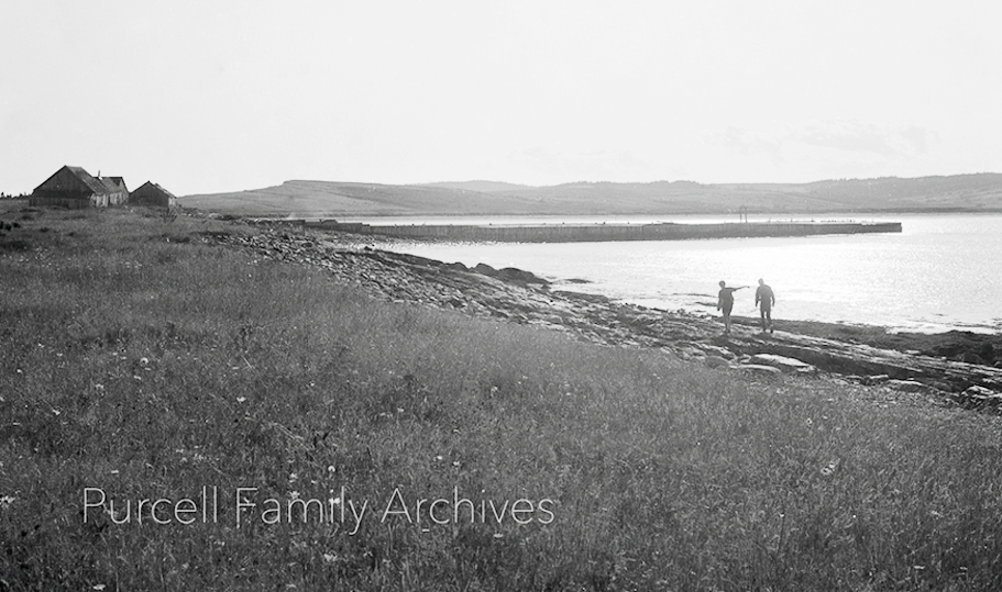
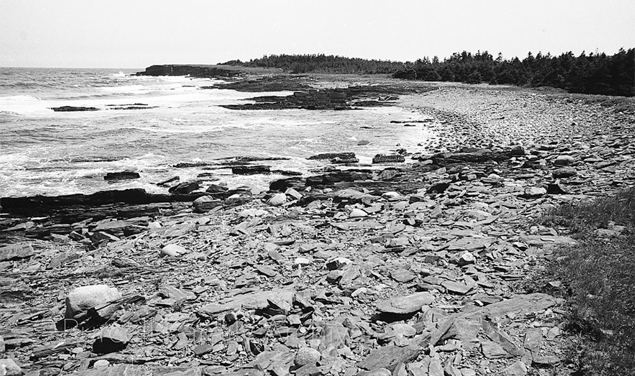
PHOTO 1 - Before going further, the geography of the area where this photograph was taken should be explained, as many of the photographs were taken here. Kingsburg Beach runs south from Kingsburg Village. It terminates at its south end where Hell Point stretches further south. Here the coastline veers east, the coast along this stretch being very rocky. It continues in a southwest direction until, at a spot called Zinck’s Point, it veers dramatically southwest towards a spot called Dry Spitz.
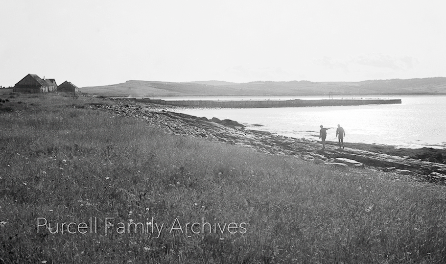
PHOTO 2 - In this photograph, the walkers are walking along this coast in a west direction towards Kingsburg Beach. Kingsburg Wharf extends into the water of King’s Bay, just ahead of them. The wharf projected from land that is now part of the property owned by Terry and Tracy Hartford. The buildings to the left, probably a mixture of barns and fish stores, were located where Rod Burgar and Susan Spence’s ‘Church House’ property is now located. Beach Hill can be seen rising in the distance.
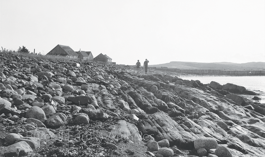
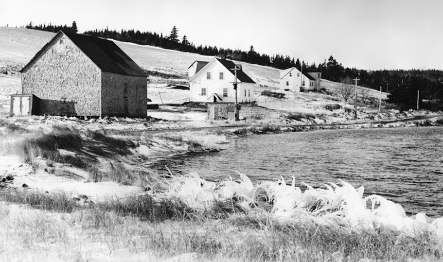
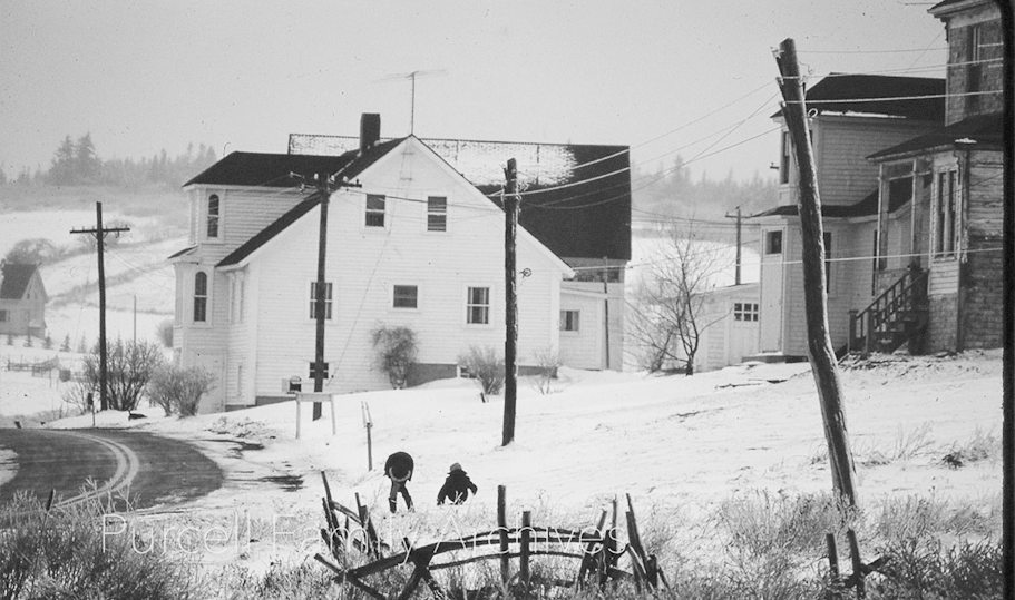
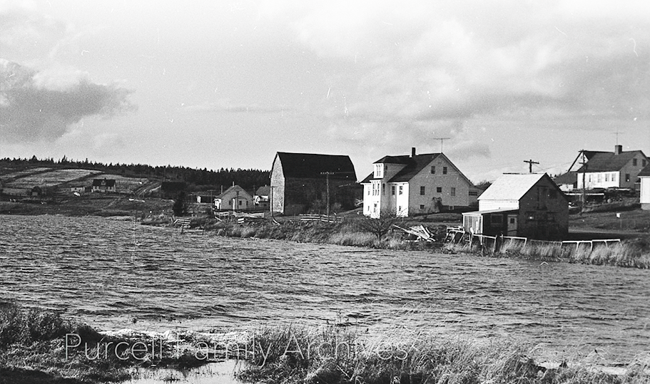
PHOTO 3 - Southwest end of Hirtle’s Pond just before Hirtle’s Beach. The barn and the two white houses belonged to the Hirtle family. The first house, just beyond the barn had been built by a Nathan Hirtle in the 1840’s. At the time the photograph was taken it was lived in by Gladys Hirtle, the proprietor and chief cook at the famous ‘Gladee’s Canteen,’ situated a short distance down the road on Hirtle’s Beach. Her youngest brother Cyril, later a well-known and highly collectible folk artist, lived with her. Gladys died in 1986. Cyril continued to live and practice his art in the house until 1993. The barn no longer exists.
The second white house was originally also a Hirtle property, but by this time it was owned by the retired American businessman, Donald MacKay and his wife Adina, born a Mossman in Rose Bay. The MacKays owned a portion of Hirtle’s Beach and, committed to preserving the whole expanse in as pristine a condition as possible. They led the campaign to have it come under provincial ownership; this came about in December 1988, the signing ceremony taking place in the MacKay house.
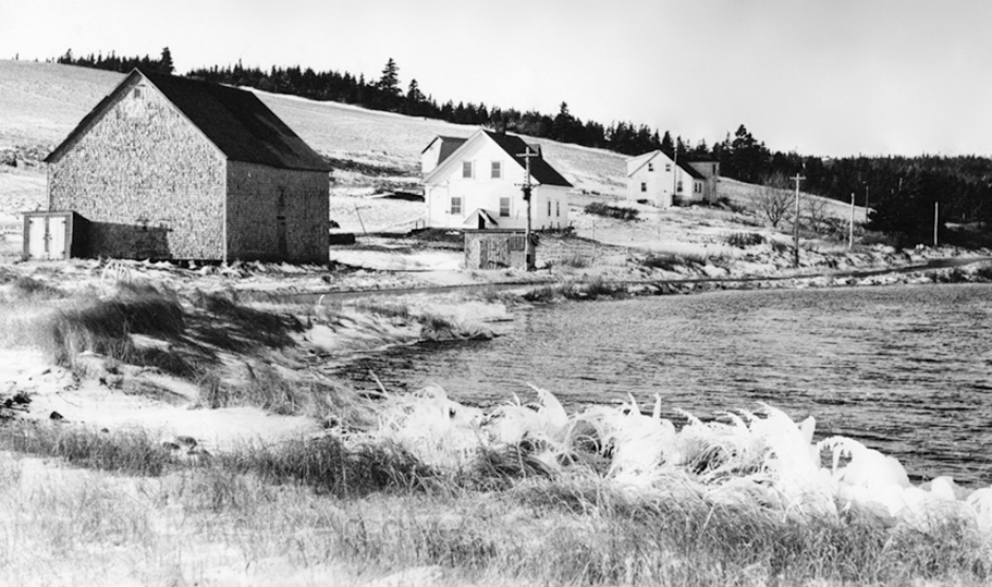
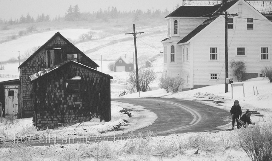
PHOTO 4 - This photo shows the barn on Kingsburg Pond across from the house now owned by John Duckworth and Anne Fouillard. The barn on the road, projecting out from behind Duckworth’s, was owned by Clarence and Olive Ernst. It burnt down in a devastating fire, probably an act of arson, in 1981. The Ernst’s house was further back on Kingsburg Road, not visible here. The house beyond the barn belonged to William Mossman and his wife Doris, it remains occupied by Mossmans to this day.

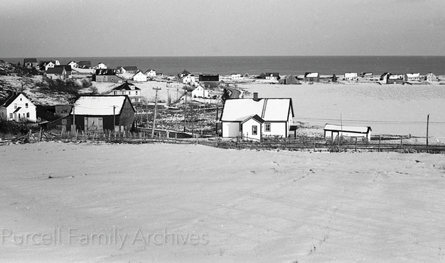
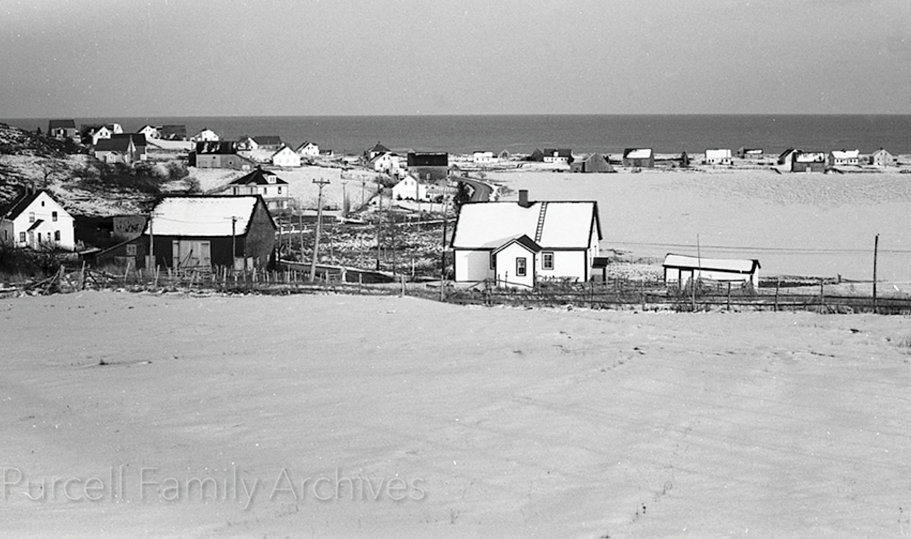
PHOTO 5 - Looking down form the hill leading into Kingsburg, the village laid out before the camera, Kingsburg Road was to the left. The house now owned by Noreen Channels and husband Don Galbraith at the corner of Kingsburg and Hirtle’s Beach Road, is in the foreground. At the time of the photograph it was occupied by William Mossman and wife Anna. William was called Saunders’ Willie, after his father, the previous owner. To the left across the road can be seen the barn owned, until recently, by Hazen and Jill Truman and beyond it, their house. The house was built by Obadiah Mossman. By 1972 it had come under the ownership of David Walmark, who has since moved to a house on Hirtle’s Beach Road. Beyond that, the large four-square was built by Elijah Mossman in 1916. It was later owned for a period of time by current Kingsburg resident, Daniel Wilson. It is now the property of Megan and Geoff Harlan.
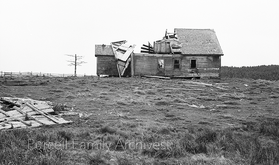
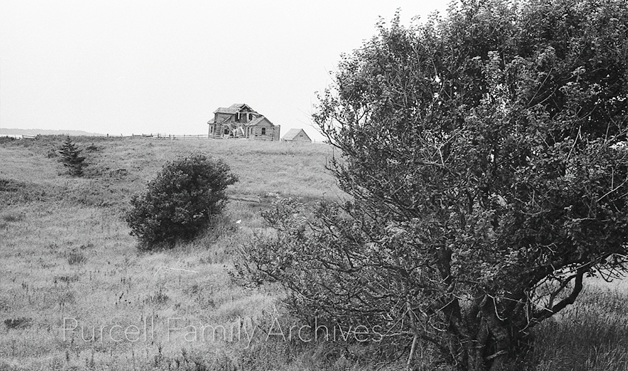
PHOTO 6 - Unidentified.
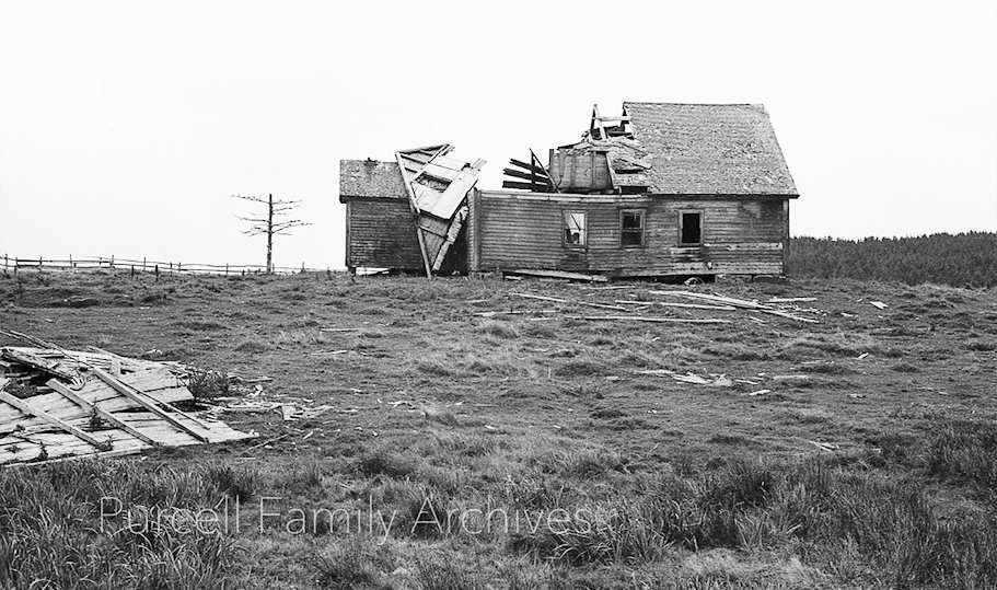
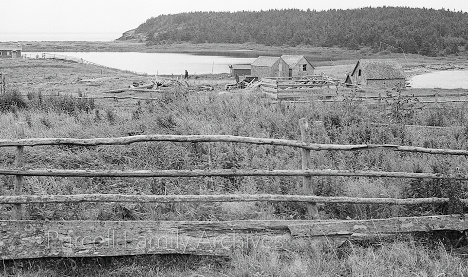
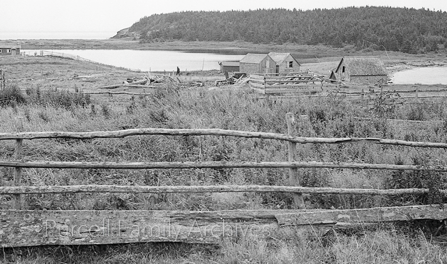
PHOTO 7 - Looking towards Mosher’s Pond and Gaff Point, from what is now the Brian Mackay-Lyons property, Upper Kingsburg.
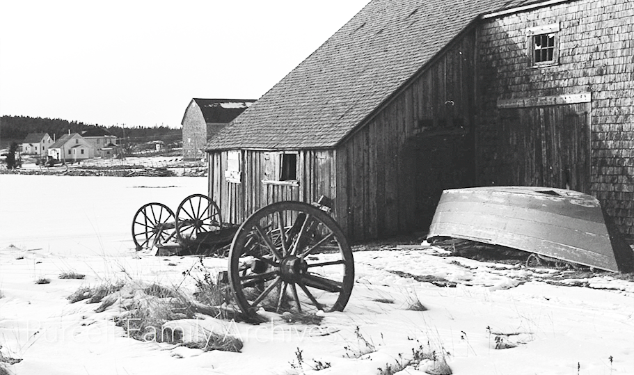
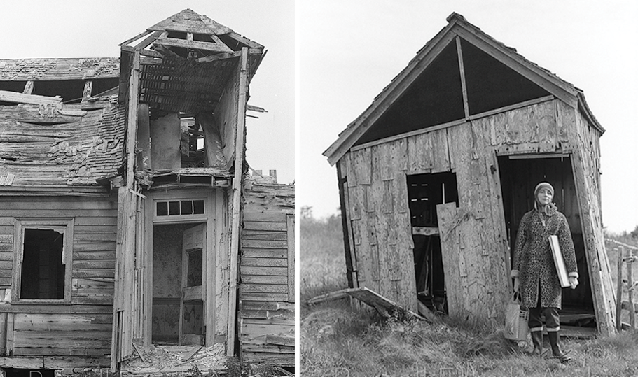
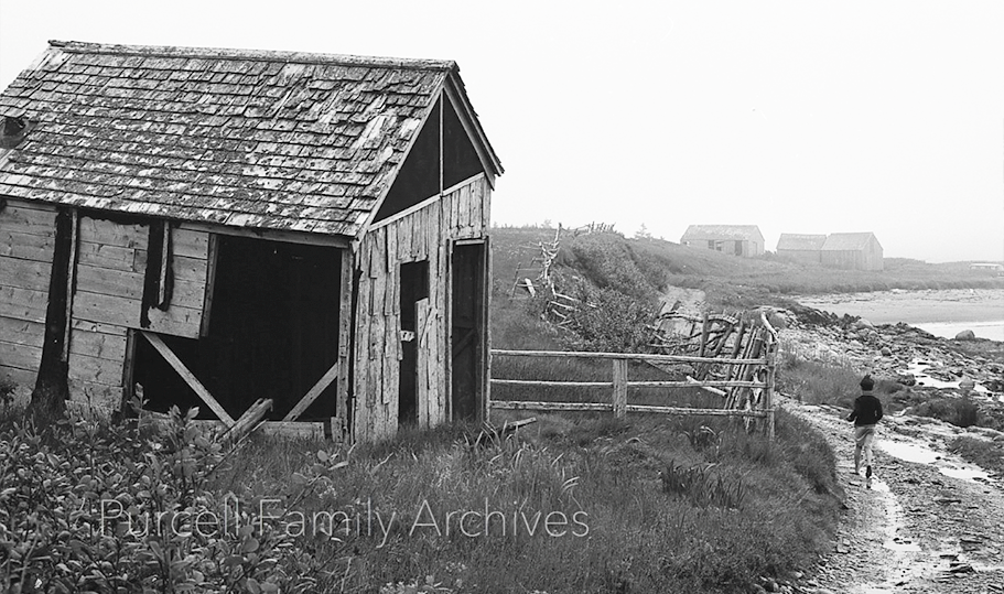
PHOTO 8 - Two disintegrating properties, probably fish stores. Location unidentified. One of the photographers, Tela Purcell, can be seen standing in front of the building at the right.
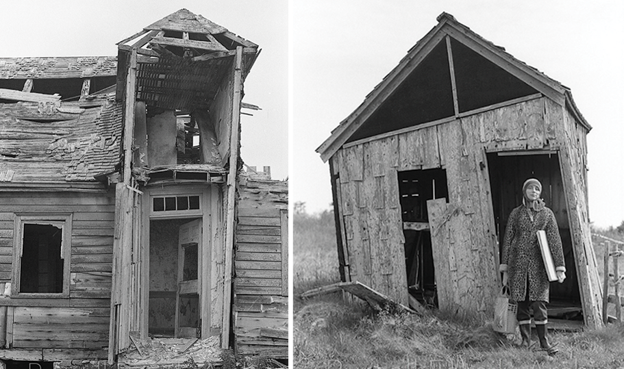
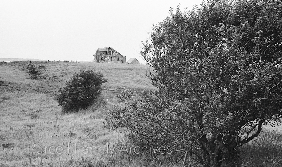
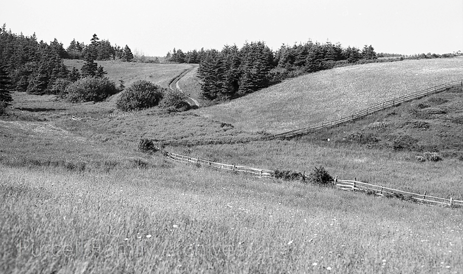
PHOTO 9 - Unidentified. Possibly Upper Kingsburg.
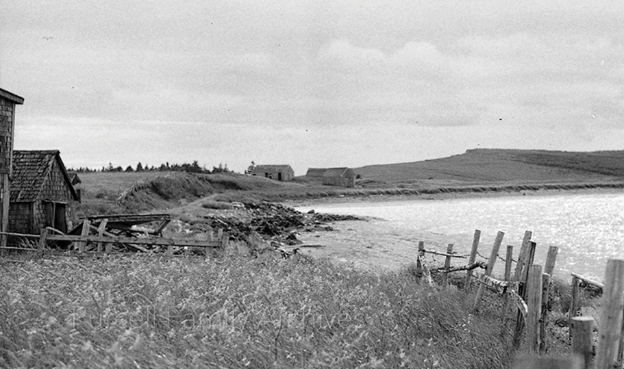
PHOTO 10 - East coast of Hell Point just north of Kingsburg Wharf. Barns and fish stores to the left, in the area where Mary St. James’s and Rob Kush’s house and Bruce MacCormack’s and Liz Wishart’s house stand today.
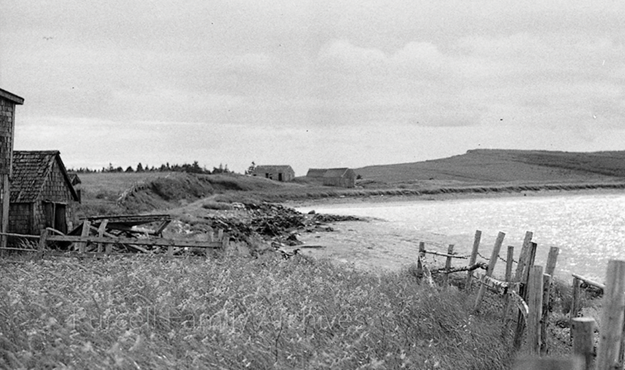
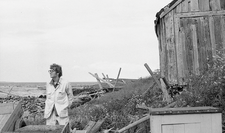
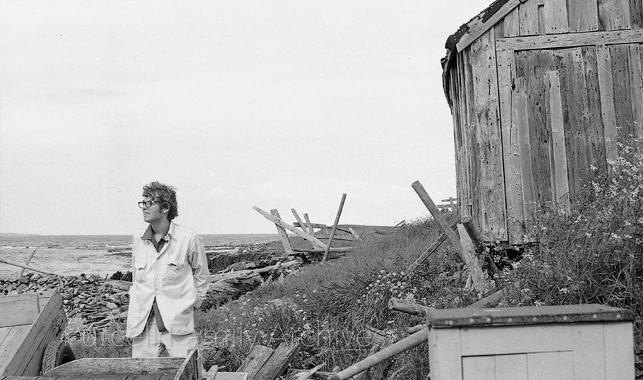
PHOTO 11 - East coast of Hell Point, north of Kingsburg Wharf. Joseph Purcell stands beside disintegrating fish store north of Kingsburg Wharf. He is looking east.
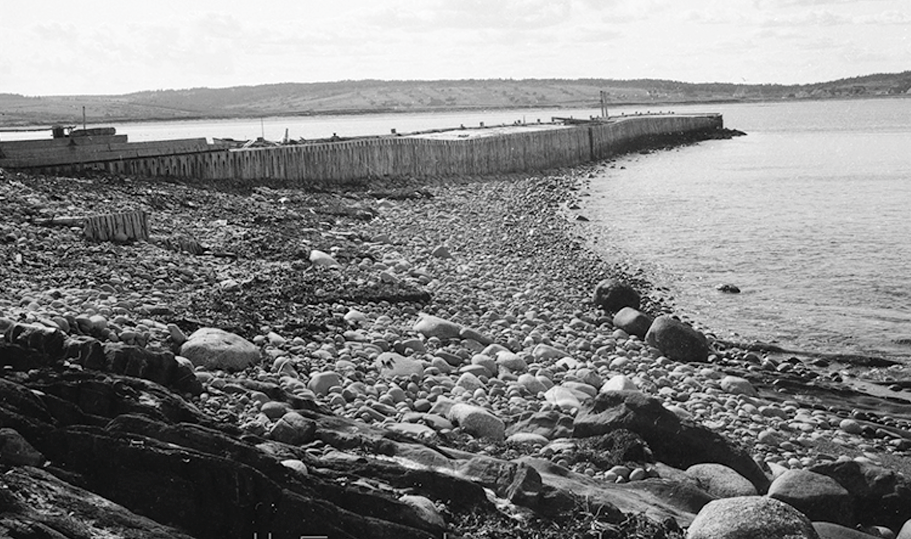
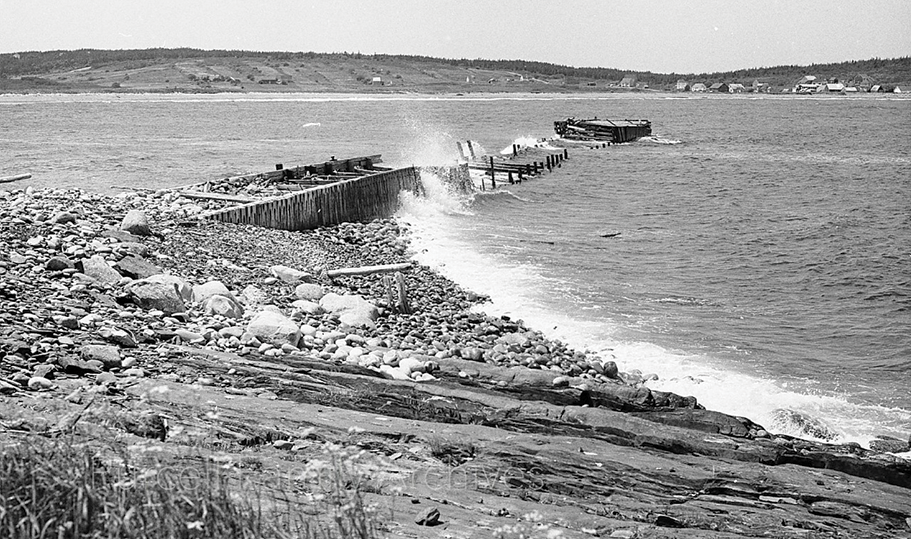
PHOTO 12 - Kingsburg Wharf at low tide, located southeast of Kingsburg Beach, extending from land that is now part of Terry and Tracy Hartford’s property. David Mossman writes in Gladee’s Canteen, that there were “breakwaters established [on]…. The Hell…. and there were two – [and they] did not long withstand the sea’s assault.” When the first one disintegrated after a succession of nor’easters, Frank Risser went ahead in the mid-1950s and rebuilt a stouter edition in the same location, with much the same result after a decade or so.” This photograph probably dates from the mid to late 1960s.
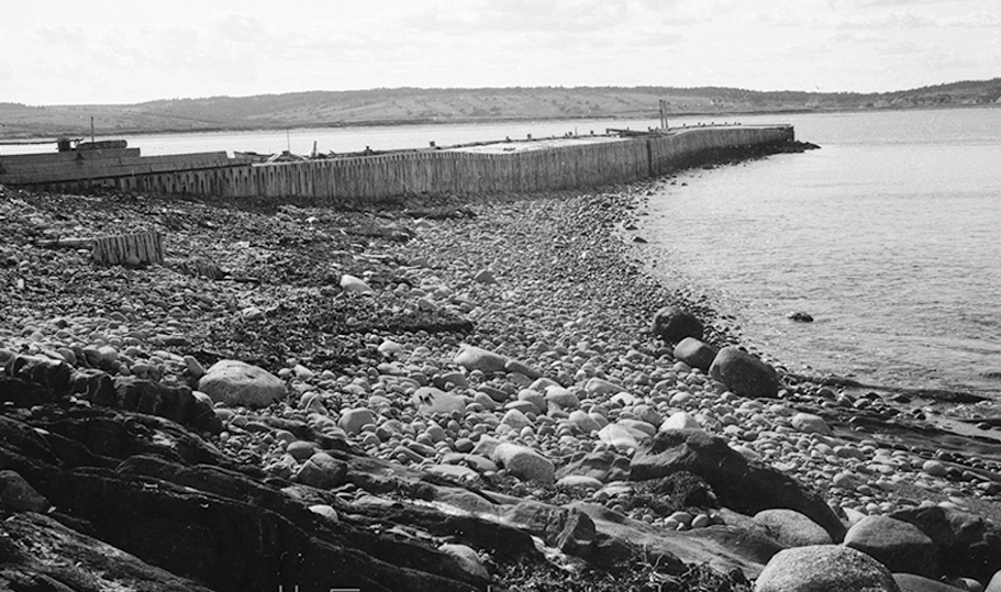
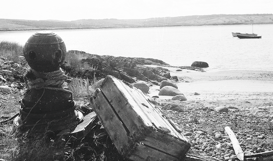
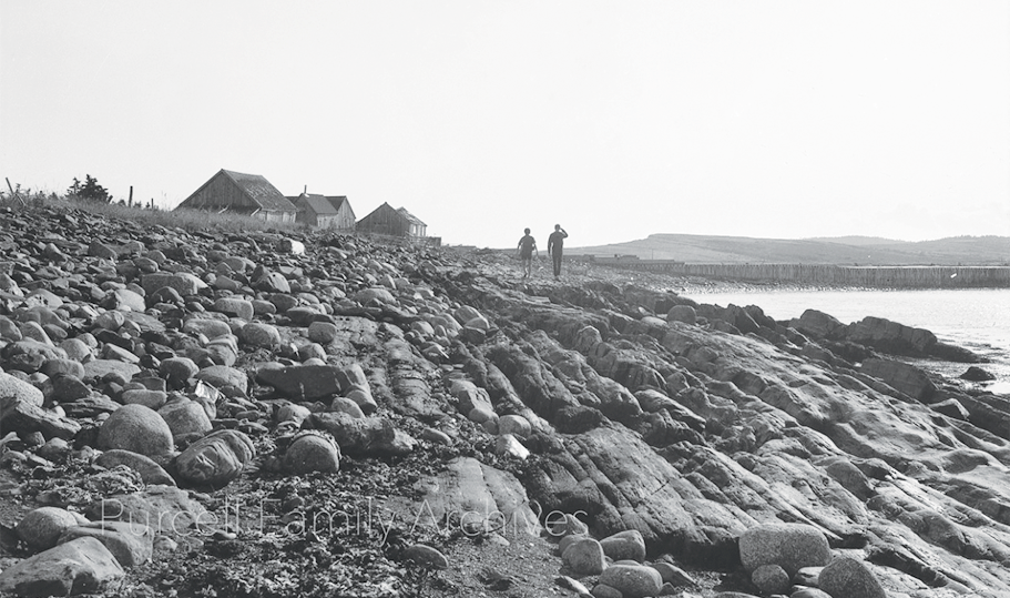
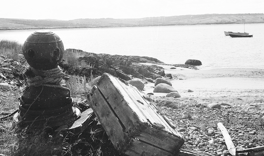
PHOTO 13 - A cove on Hell Point’s east coast, just northwest of Kingsburg Wharf. Fishing boats, as seen in the bay, often tied up here to unload their catch rather than proceed to Kingsburg Wharf. The round metal device to the left is a bollard, around which ropes, as seen here, were looped to secure the vessels. The box-like item to its right is an early form of lobster trap. The crustaceans crawled in through holes in the top..
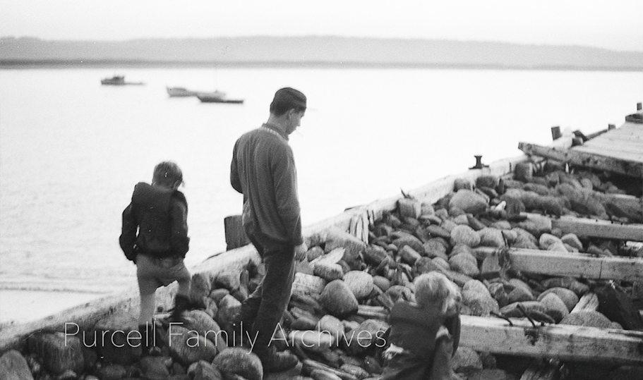
PHOTO 14 - A man and kids examine the uncovered rocks of Kingsburg Wharf, then in the early stages of disintegration, mid-to-late 1960s.
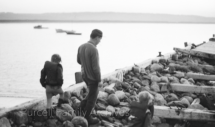
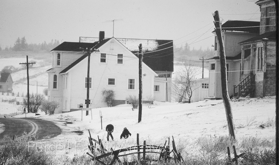
PHOTO 15 - Clarence and Olive Ernst’s house, Kingsburg Road, now occupied by Sean Kennedy of St. Mary’s University. To the right the house now lived in by Susan Hall can be seen. It was built by Samuel Mossman, date unrecorded. After many changes of ownership it was bought by Gilbert Wilkie, who owned it at the time of the photograph. Protruding into the photo at the right a portion of the house now occupied by Diana Pepall and Cameron Pulsifer can be seen. It was built in 1903 by Thomas and Ada Knock, under whom the building served for many years as the Kingsburg post office. After the Knocks’ deaths it went through a number of changes of ownership until, in 1975, in the words of Edith Knock, “lawyer Saunders owns it yet”.
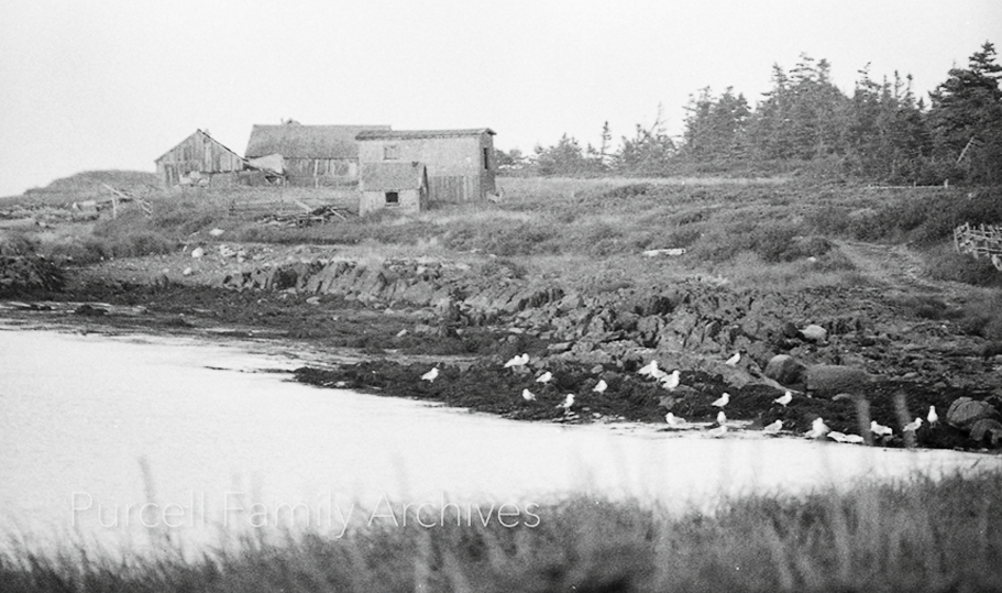
PHOTO 16 -Barns and fish stores, overlooking King’s Bay from Kingsburg Beach.
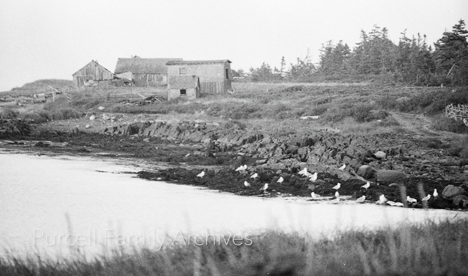
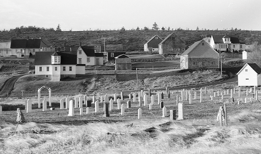
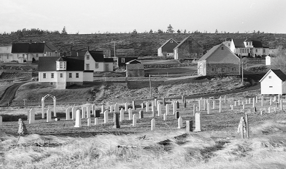
PHOTO 17 - Strandfriedhof cemetery, the oldest in the Kingsburg area, located behind the old school house, towards Kingsburg Beach. The photograph provides a good view of the hill leading towards Rose Head. The house at the immediate left was owned by Lloyd Florence Knock, and is now owned by Marcella Kadanka and husband John Robertson. The house above it was the home of Wallace and Eva Knock, now occupied by Ralf Kohlhepp and Christina Weidmann. Wallace was the village blacksmith, who practiced his business on the property. Above it to the left is the house now owned by Judy Burch. It was then the property of Fred and Jean Deal. The house at the top right with the dormer was built by an Emanuel Knock, date unrecorded. He sold it in 1914, and it was acquired soon after by Captain Frank Risser and wife Stella, who, after carrying out extensive renovations, lived in it until their deaths in the early 1950s. They left it to their son Marshall Risser, who probably resided in it when the photograph was taken. It is now owned by the Anne Doran family. The barns belonged to the owners of the adjacent properties.
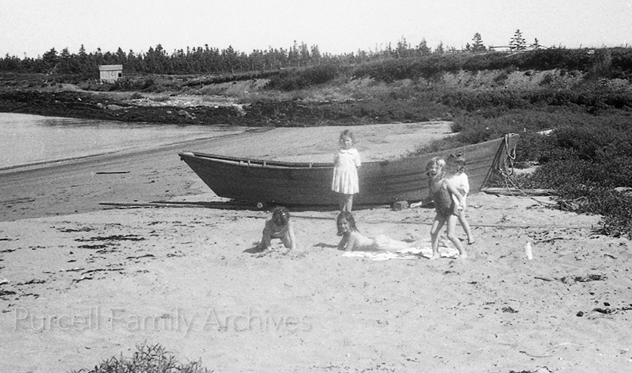
PHOTO 18 - Unidentified children playing at the east end of Kingsburg Beach, beside a dory.
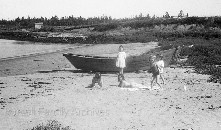
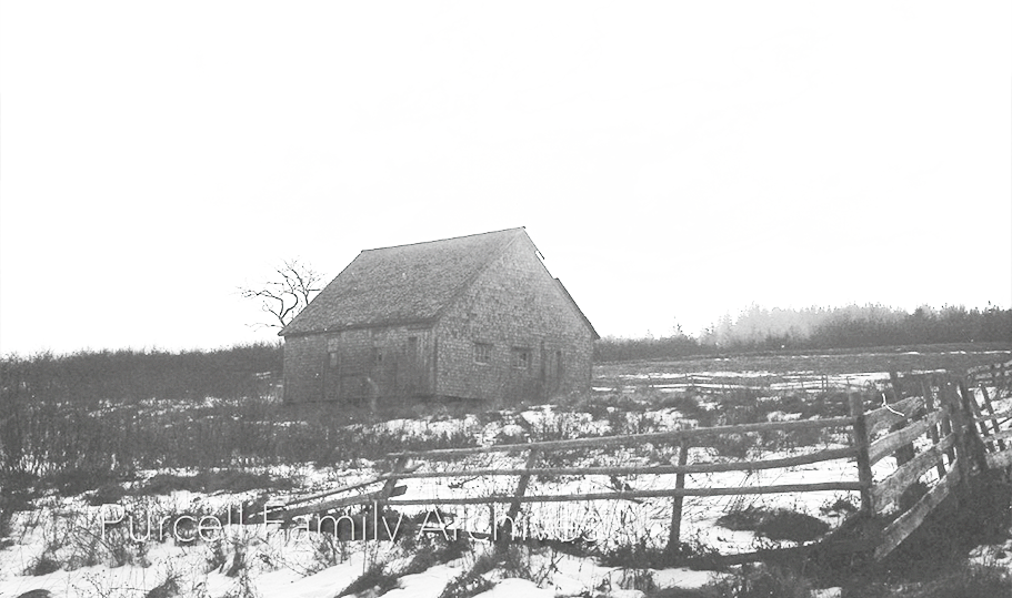
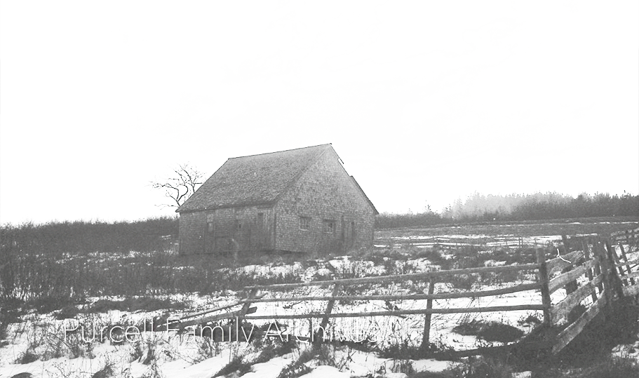
PHOTO 19 -Unidentified barn.
PHOTO 20 -To the right, Clarence and Olive Ernst’s house, now occupied by Sean Kennedy. Across the road are two buildings that at the time were owned by Gilbert Wilkie. The closest to the camera was a fish store. The Judy Burch family, who later owned these buildings for a time, had it moved to their own property, a field on the hill behind the Pepall-Pulsifer residence, to serve as a bunkie. It is still there. The building behind it was for general stores. This building no longer exits.
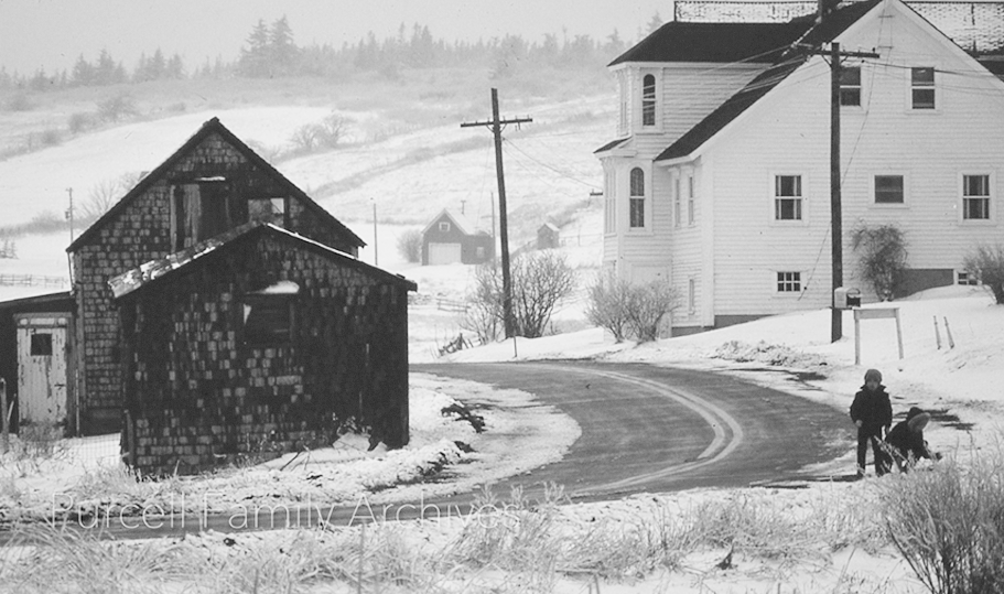
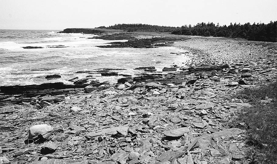
PHOTO 21 -Rocky beach, near Kingsburg Wharf, on the east coast of Hell Point.
PHOTO 22 -Kingsburg Wharf in the later stages of breaking up. Probably late 1960’s. The wharf was a valued community resource, where fishing boats could be tied up, while it also served as a breakwater for Kingsburg Beach. Local memory recalls that, much against the wishes of the community, its demolition was assisted by a local firm anxious to sell the timbers.
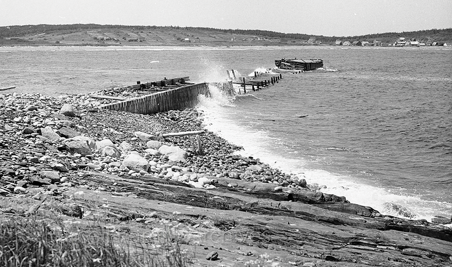
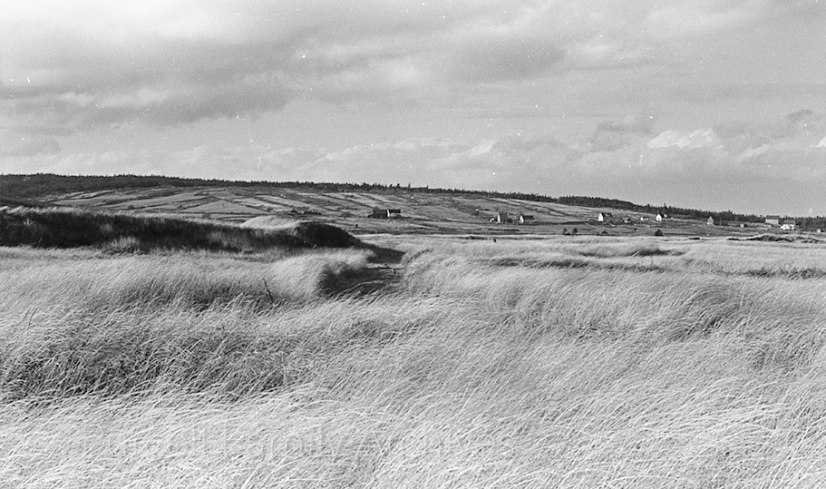
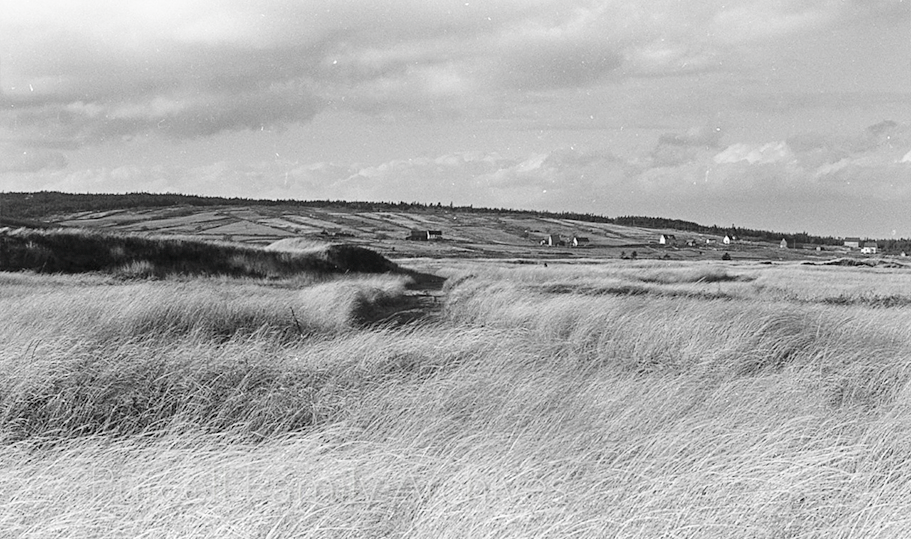
PHOTO 23 - – Looking north from the dunes behind Kingsburg Beach, across grasses and Kingsburg Pond towards Hirtle’s Beach Road in the distance.
PHOTO 24 -Unidentified. Possibly Upper Kingsburg.
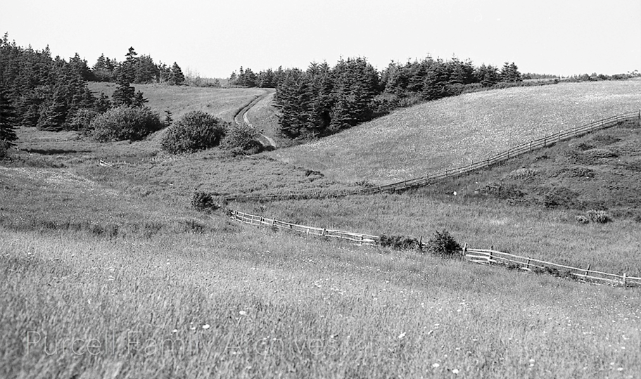
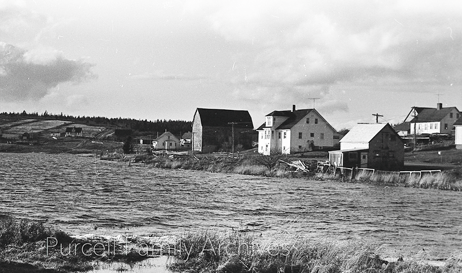
PHOTO 25 - Looking northwest across Kingsburg Pond towards houses on Kingsburg Road. The Lamont and Carole-Anne Mosher house can be seen at the top right. Below it is the store property owned by Gilbert Wilkie. The fish store has by this time been removed. To the left is the Clarence and Olivia Ernst house, now owned by Sean Kennedy. Beyond it is the Ernst’s barn, which burned in a catastrophic fire in 1981.
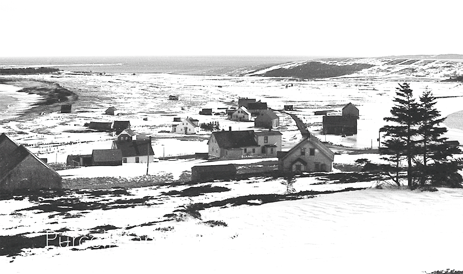
PHOTO 26 -Winter view of Kingsburg village looking down from Rose Head hill. Stretching eastward at the left is Kingsburg Beach. The house closest to the camera was bought in 1972 by long-time Kingsburg resident and land-owner, the late David Murphy of Halifax. It remained in his and his wife Sonia’s hands until their recent deaths. It is now owned by Michael Cole. Below it, to the left, is the house now lived in by Alex MacDonald and Mike Arnoldi. The first house to the left down the hill is that of John Duckworth and Anne Fouillard, occupied when the photograph was taken by Bennet and Edith Knock. The latter wrote the much-valued house-by-house account of Kingsburg in the 1970’s, used extensively as a source for this account. Beyond it, to the right, is the barn that residents refer to as The Duckworth Barn.
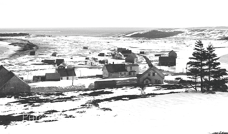
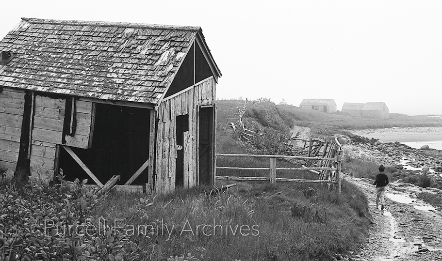
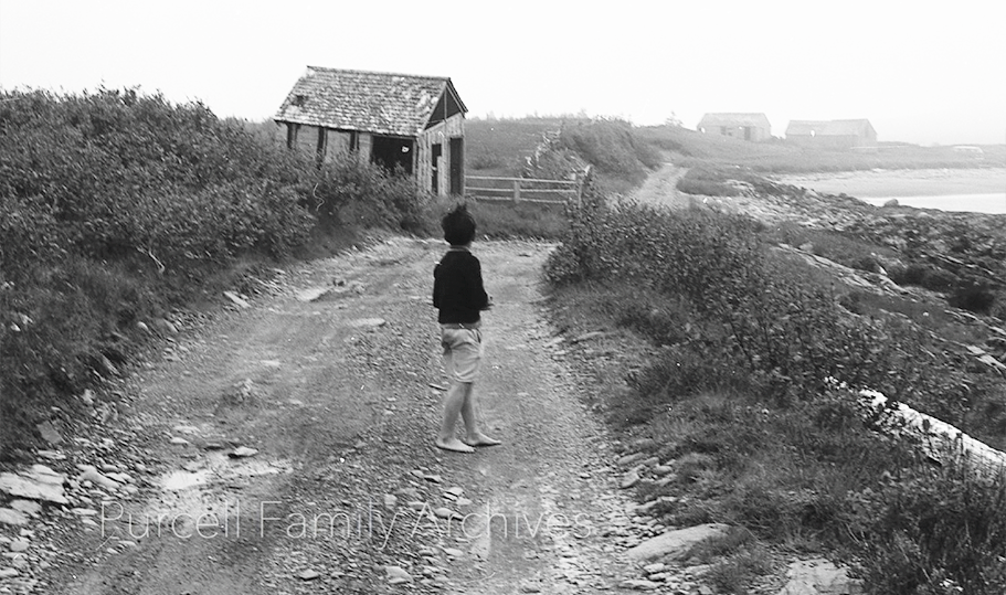
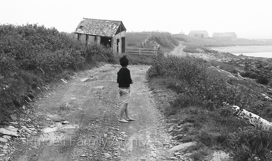
PHOTO 27 - East coast Hell Point. Youth walking along road heading northwest towards Kingsburg Beach.
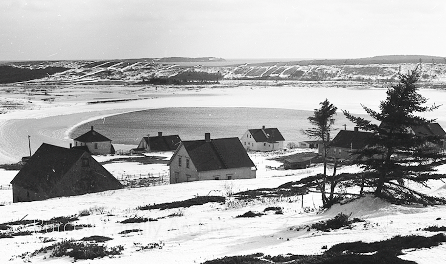
PHOTO 28 -Another winter view from Rose Head hill overlooking Kingsburg Village. Dr. Murphy’s house is to left, and to the right of it is the house now occupied by Alex MacDonald and Mike Arnoldi. The three houses further down are from left to right those occupied today by the Pepall-Pulsifers, Susan Hall, and Sean Kennedy. The unpopulated Beach Hill, with ancient property lines referred to by David Mossman, clearly visible. Beyond that in the distance, West Ironbound Island can be seen.
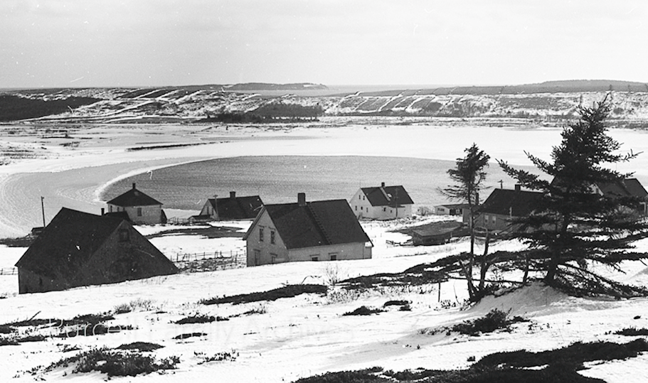
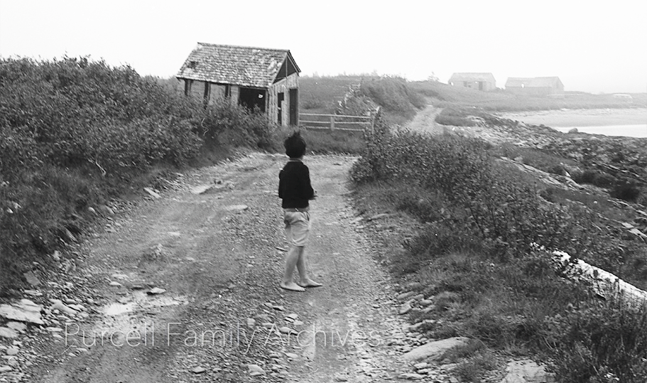
PHOTO 29 - Same as photo 27, only the walker is slightly further back on the road.
PHOTO 30 - South coast Hell Point. Looking across Little Hirtle’s Beach from the bottom of the Beach Hill path. The land across the water leads, to the right, to the lengthy projection into the water called Hell Reef.
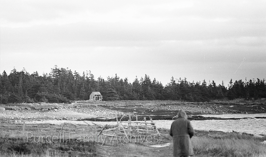
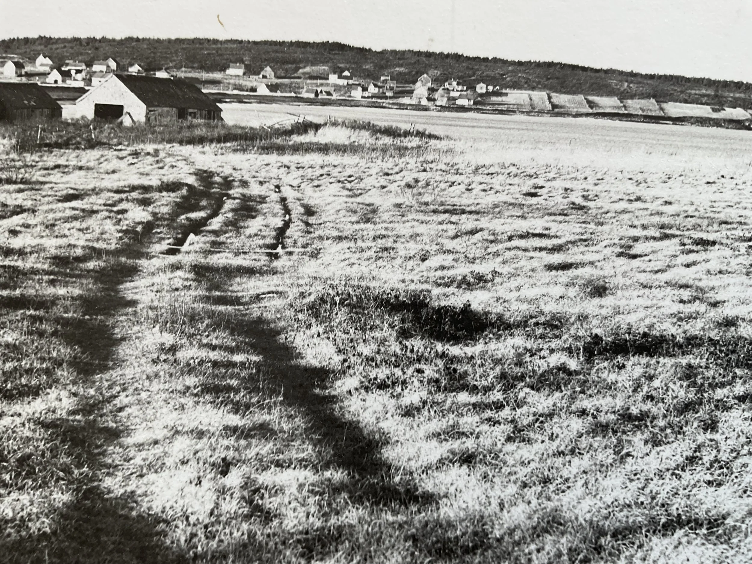
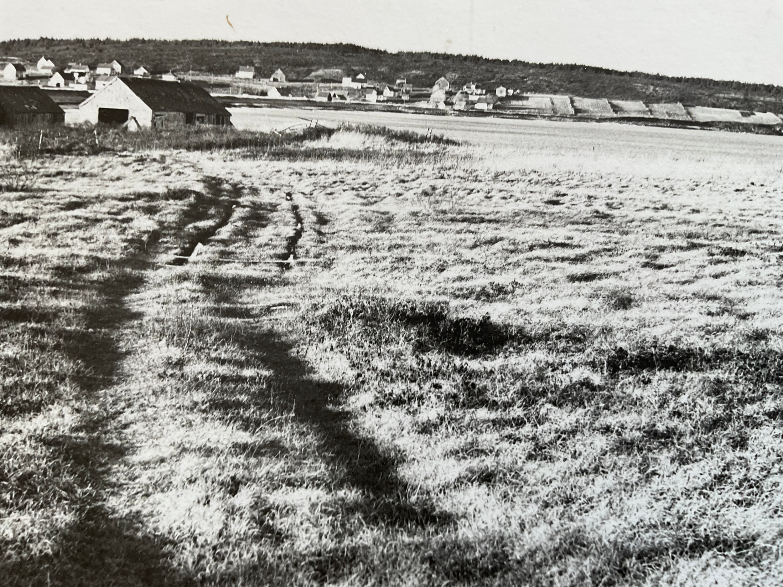
PHOTO 31 - Purcell photograph owned by Dan Wilson, dated 1961. This photograph was taken from the road leading to Hell Point, looking west towards Kingsburg Beach, with Kingsburg Village in the distance. Apparently barns and fish stores, these buildings were located on the dunes at the eastern end of Kingsburg Beach, and are probably the same ones seen in photos 10 and 16. The land was then completely open whereas trees and bushes have sprung up since.
If you would like a closer look at any one of these images, just click on a thumbnail below.